Today, I have Google Maps on my brain because this is a tool I'm currently using with several classes. Student created Google maps are a great way to publish work and/or to show what has been learned! Students can collaborate on a map or create them individually.
Currently, 1st graders are tracking their Flat Stanley project on this google map.
Currently, 1st graders are tracking their Flat Stanley project on this google map.
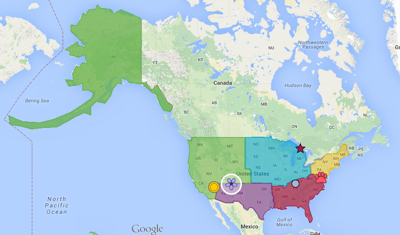
In the upper grades, my 4th graders are learning about the US Regions. The created shapes around the region to show its location. Then, they created postcards from each region to talk about a specific landmark in that region. The classroom teachers have been able to assess students' writing and understanding of the social studies concept throughout this project.
In this project, students shared the links to their map in our Google Classroom. Then, we compiled them all into a Google Site to make it easier to share with parents and families.
How do you use Google Maps? Please share in the comments below!
How do you use Google Maps? Please share in the comments below!
 RSS Feed
